|
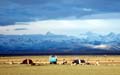
Numerous lofty mountains form many mountain systems, which serve as the framework of China's topography. Well-known mountain ranges include the Himalayas, the Kunlunshan Mountains, the Tianshan Mountains, the Qinling Mountains, the Greater Hinggan Mountains, the Taihangshan Mountains, the Qilianshan Mountains and the Hengduanshan Mountains.
Himalayan Mountain Range Extending more than 2,400 km in a crescent-shape along the Chinese-Indian and Chinese-Nepalese borders, it has an average elevation of 6,000 meters. It is the world's highest and largest mountain range, and its main peak, Qomolongma, is 8,844.43 meters above sea level, the highest in the world.
Kunlunshan Mountain Range Extending over 2,500 km from the Pamirs Plateau in the west to the northwest of Sichuan Province in the east, it has an average elevation of 5,000 to 7,000 meters. Its highest peak, Kongur, is 7,719 meters above sea level.
Tianshan Mountain Range Traversing Xinjiang Uygur Autonomous Region, it has an average elevation of 3,000 to 5,000 meters, with its highest peak, Tomur, being 7,455.3 meters above sea level.
Tanggula Mountain Range Situated in central Qinghai-Tibet Plateau, it has an average elevation of 6,000 meters. The Yangtze River rises from its highest peak, Geladaindong, which is 6,621 meters above sea level.
Qinling Mountain Range Stretching from east Gansu Province in the west to the west of Henan Province in the east, it has an average elevation of 2,000 to 3,000 meters. Its main peak, Taibaishan, is 3,767 meters above sea level. It is an important geographic line of demarcation between north and south China.
Greater Hinggan Mountain Range Extending 1,000 km from Mohe of Heilongjiang Province in the north to the upper reaches of Laohahe River at the juncture of Inner Mongolia and Liaoning Province in the south, it has an average elevation of 1,500 meters. Its main peak, Huanggangliang, is 2,029 meters above sea level.
Taihangshan Mountain Range Extending over 400 km along the eastern fringe of the Loess Plateau from north to south, it has an average elevation of 1,500 to 2,000 meters. Its main peak, Xiaowutaishan, is 2,882 meters above sea level.
Qilianshan Mountain Range Stretching along the northeastern fringe of the Qinghai-Tibet Plateau, it has an average elevation of over 4,000 meters. Its main peak, Qilianshan, is 5,547 meters above sea level.
Hengduanshan Mountain Range Situated at the juncture of Tibet, Sichuan and Yunnan in the southeast of the Qinghai-Tibet Plateau, it has an average elevation of 2,000 to 6,000 meters. Its highest peak, Gonggashan, is 7,556 meters above sea level.
Taiwan Mountain Range Running through the eastern part of Taiwan Island, it has an average elevation of 3,000 to 3,500 meters. Its main peak, Yushan, is 3,952 meters above sea level.
|